H*Wind Display
The NOAA's Atlantic Oceanographic and Meteorological Laboratory (AOML), Hurricane Research Division operates the H*Wind Project. The purpose is to devise computer programs to integrate wind data in and around a hurricane from a variety of platforms into a single wind analysis reduced to the surface. See http://www.aoml.noaa.gov/hrd/Storm_pages/surf_background.html for more information.
H*Wind display provides an interactive way to view this data as well as do some impact analysis.
Important: H*Wind data is imported into the system via Hurrtrak Online. The user must manually request the latest H*Wind data via the HURRTRAK ONLINE Tab in the HURRTRAK system.
Availability: Because this is not NHC operational data but rather experimental data put out by AOML, data availability is highly variable and at the discretion of AOML. We will make data available as it becomes available to the "public" as the AOML web site.
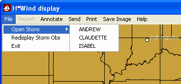
When the H*Wind display system is started, if data exists in the H*Wind database, the user will have the option of opening a "storm".
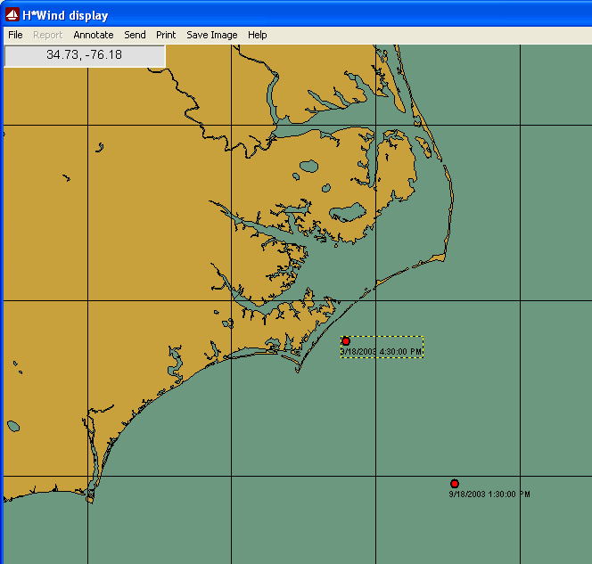
When a storm (Isabel) is opened, the user is presented with the following screen.
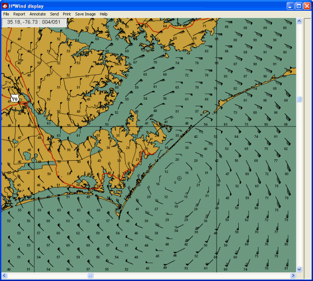
The user then can select a specific observation by left clicking on the observation point (storm center). After selecting, the following screen is presented showing some of this storm's H*Wind observation data. Point wind direction (arrows) and speed (in knots) are displayed. Zooming in or out will display more or less information (see Pan and Zoom mapping for more information). In addition mouse cursor position information of latitude, longitude, wind speed and direction is shown in the information box in the upper left corner.
While viewing the graphics, there are several menu options available. They include:
File Report Annotate Send Print Save Image Help
.