Tracking Chart Maintenance
Tracking
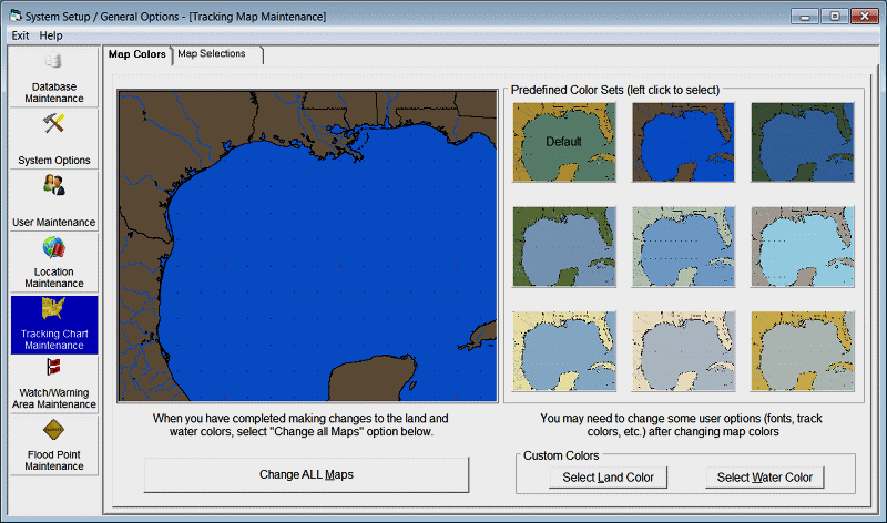
Chart maintenance has 2 functions.. The first function shown on the image above allows
the user to change the default map colors. There
are 9 pre-defined color sets as well as the capability to define your own custom
colors. The options on this page are:
Land
Color
- This option allows the user to select the color of the land areas on all the tracking
charts.
Water
Color
- This option allows the user to select the color of the water areas on all the tracking
charts.
Change
ALL Maps
- This option will process the color changes to all of the tracking charts on the
system.
Selecting
one of the pre-defined images will preview what the maps will look like before selecting
the “change all maps” option..
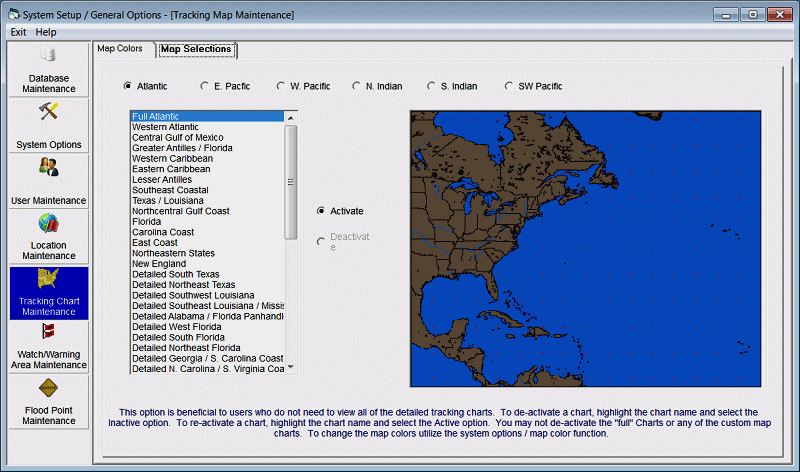
With the large number of tracking charts in the system, some users may find it beneficial to be able to de-activate certain charts that they would never use. This options allows the user to be able to do just that. To de-activate a chart, highlight the chart name and select the inactive option. To re-activate a chart, highlight the chart name and select the Active option. You may not de-activate the "Full Atlantic" chart or any of the custom map charts. Global Tracker users can change tropical cyclone basins by selecting that menu option.