Overlay Control Center
The
system includes the ability to display a shape file layer on top of a "variable"
type map used for tracking. The shape
file is converted to a proprietary format (PWC) used by the Hurrtrak system.
Once converted, it can quickly be loaded without conversion in the future.
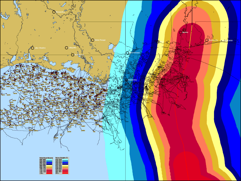
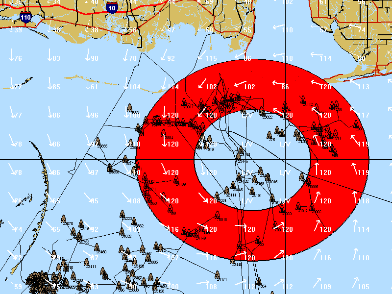
The image below shows platforms and pipelines in the Gulf of Mexico along
with the forecast wind speeds and wave heights from Hurricane Ivan.
From
the Map Selection Tab, when the Display Overlay Control Center is selected, the following
screen is displayed.
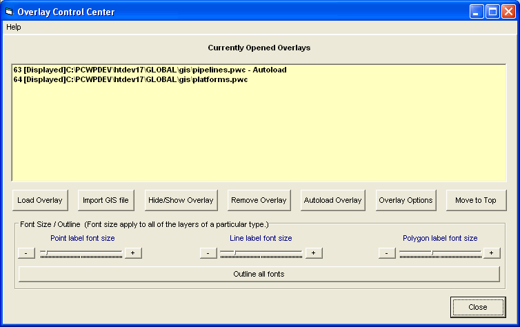
The screen displays the overlays currently loaded as well as several options.
These
options include
Load
Overlay
– This loads an existing PWC file.
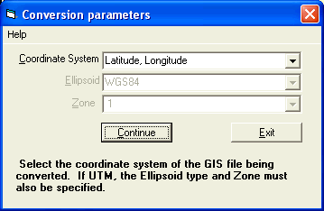
Import
GIS File
– This option will convert a Shape ™ file into PWC format and load it.
The user must have some knowledge of the Shape
file, particularly its coordinate system, Ellipsoid and UTM zone (, if applicable).
Hide/Show
Overlay
– This option will change the layer from being visible to being invisible but
keep it loaded at all times.
Remove
Overlay
– This option will remove the overlay.
Autoload
overlay –
This option will instruct the system to automatically load this layer the next time
HURRTRAK system starts up. Otherwise it will not be loaded.
Move
to Top –
This option will take the currently selected overlay and make it the top layer.
Overlay
Options
– This option will display a new set of screens that allows the user to control
the way a specific layer is displayed, colors and any labeling.
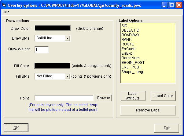
It also will allow the user to select a small .bmp file to represent points in a GIS layer. (i.e an oil platform icon for that type of asset).
At the bottom of the main overlay control screen, there are additional options which allow the user to control the different types of layer’s font size and appearance.
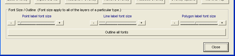
While
different layer can be displayed differently, the font size for one type of layer
are all the same.. i.e. the font for multiple point layers are the same size.
Label colors can be assigned by layer.
NOTE:
You can download some PWC files which show Oil/Gas
Platforms, Pipelines, Pipe Points and Blocks as well as US State Borders and US Highways/Interstates,
and man made Dams
from our web site at http://www.pcwp.com/ftp/pwc.zip .