Advanced Wind Estimation for high heights/elevations (agl)
An
additional capability of Advanced Wind Estimate (AWE) is the ability to estimate
winds at different heights (above ground level).
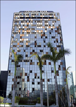
Examples include high-rise buildings, the top of a construction rig, power
lines… or any structure that is higher than the “standard” wind estimation
level of 10 meters (33 feet). This is not
designed to calculate winds for high terrain (mountains, etc.) as there are many
other factors that come in to play in those regions.
As
mentioned above the Hurrtrak system normally calculates winds at a 33 foot level…
which the worldwide standard for wind instruments, etc.
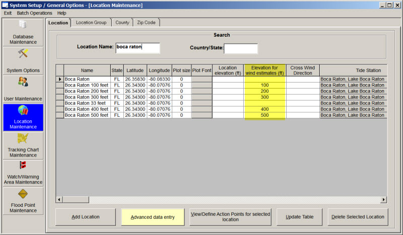
To setup a location for a higher elevation/height you would enter the height
information (feet) into the “Elevation for wind estimates” field within
the location maintenance section of the System Setup options.
See an example below of where we created several locations (at the same site)
with varying elevations. (You can enter elevations
up to 1000 feet).
When
you run the Location Wind Impact Report (or any report) these locations will now
show winds at the height you defined. The
example below is for the same locations with varying heights.
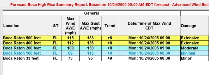
As
you can clearly see the wind speed forecast increase with height as expected.
What might be a Cat 1 storm near the surface can be a Cat 3 wind at 500 feet.
As with any of the AWE estimates, the wind speed values should be used with
some care. See the AWE Topic for more information.