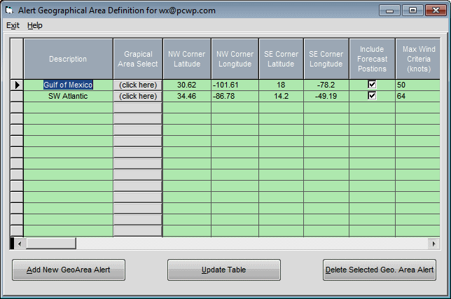
Geographical Area Alert Setup
This option allows the user to specify Alert Conditions based the actual and/or forecast position of a storm.
The data fields which define this data are:
Description - Description of the geographical area
Graphical Area Select – This command presents the user with a large map whereby via mouse commands they can easily select a geographical area. After accepting the area, the map corner latitude and longitudes are automatically filled in. This is much easier than defining them manually.
NW Corner Latitude - The geographical area defined must be in the shape of a rectangle. This defines the latitude of the NW corner of that rectangle.
NW Corner Longitude - The area defined must be in the shape of a rectangle. This defines the longitude of the NW corner of that rectangle.
SE Corner Latitude - This defines the latitude of the SE corner of the geographical rectangle.
SE Corner Longitude - This defines the longitude of the SE corner of the geographical rectangle.
Remember... longitudes in the Western Hemisphere are negative so values decrease as you move westward.