Hurricane Reconnaissance Display
When
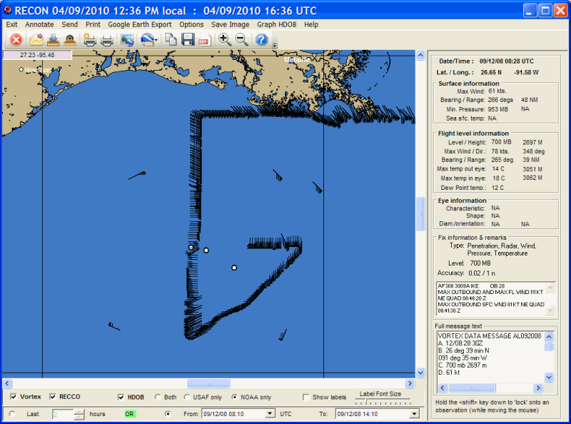
the hurricane reconnaissance program is started, the user is presented with the screen
below. At this point the user can select the mapping area they are interested
in (see Panning
and Zooming
for more information) and then perform the program functions. In
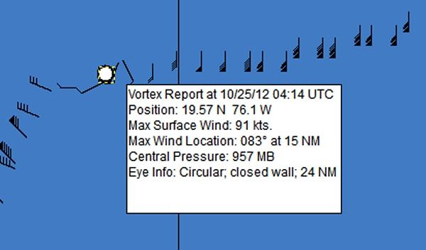
addition, as you pass the mouse pointer over an observation, a popup window will
appear providing more information.
There are 3 types of recon reports that the program displays. Point and click on portions of the image shown above for a description of what they represent and control.
The reconnaissance data
is downloaded via the HURRTRAK ONLINE service. By setting the HURRTRAK
ONLINE Automatic Data polling option, the system will check for new data on a
regular basis. You can also manually retrieve the data via the Hurrtrak Online tab
options.
While viewing the graphics, there are several menu options available. They include:
Exit Annotate Send Print Google Earth Export Options Save Image Graph HDOB Help
CLICK on the commands to learn more
In addition, as you pass the mouse pointer over an observation, a popup window will appear providing more information.