Depiction of storm's eye, eye wall and wind field
The Hurrtrak system depicts a storm's eye and eye wall (if they exists) as well as the areas of 34, 50 and 64 knot winds.
EYE/ EYE WALL:
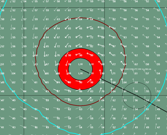
If the storm has a well formed eye structure and is reported on the NHC Forecast
Advisory, the system will use the reported eye diameter and draw a donut type structure
that looks like the image below. The eye wall width is assumed to be 1/2 of
the diameter of the eye. i.e. a 20 nm eye diameter is assumed to have an eye
wall width of 10 nm. Maximum winds are assumed to be in the eye wall with light
and variable winds in the eye.
Well formed eye example
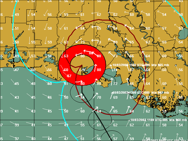
The
system does not depict partial eye walls however it does show quadrants where lighter
winds exists.. even if an eye is reported. The example below shows what is likely
to be a partial eye wall situation.
Storm with likely partial eye structure
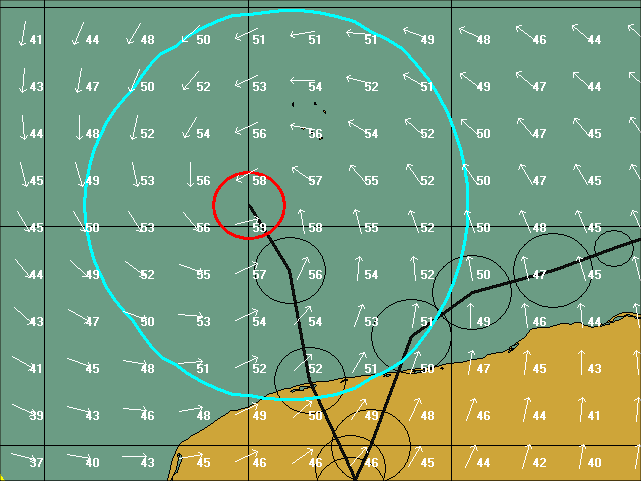
If the storm does not have an eye, the eye and eye wall width are set to 0 (via Hurrtrak
Online). In this case the system shows a small red circle indicating the center
area of the storm. Maximum winds are assumed to be near the center of the storm
Storm with no eye structure
Note: Hurrtrak Online reports an eye under the following
conditions.
1. It is reported on the NHC forecast advisory
2. If it is not reported on the NHC forecast advisory
but a storm has winds of 70 knots or greater, an eye diameter of 18 nm is assumed.
This is to cover the situation where hurricane recon is not available for the storm
but it is likely to have an eye.
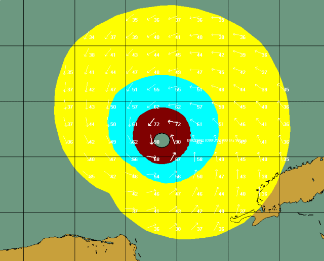
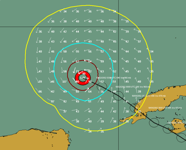
WIND FIELDS:
The 34, 50 and 64 knot winds areas are depicted based on the information in the NHC Forecast Advisory. See NHC Wind Radii Considerations for more information about the data represented in this advisory. The example below shows a 90 knot hurricane with the areas of 34, 50 and 64 knot winds depicted.
Plotting Options (wind circle vs area):
The user also has the option, via Plotting Options, to depict the wind fields as shaded areas or not
at all. The example below is an example of a storm with wind field shading.