How to show Satellite, SST, and Radar image Maps
How
it works...
Hurrtrak
Online users are able to plot a storm on certain satellite, Sea surface temperature
and Radar images. They can be selected from the Satellite image drop down list on
any of the "fixed map" tabs. The source for these maps are from 3rd party
free internet web sites.
How
to select...
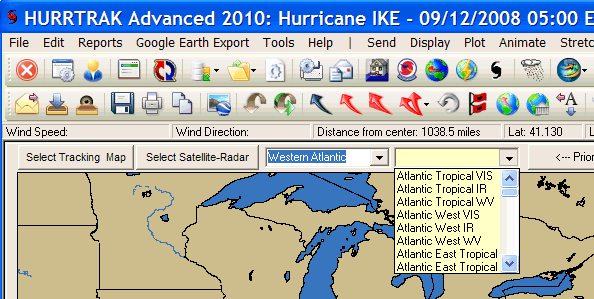
These images are selected
from any of the three Fixed Tracking Charts by selecting the Select Satellite-Radar
command or the drop down list just above the tracking chart image. i.e. you
must first be looking at a tracking chart image before they can be selected.
See below.
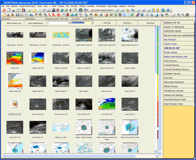
When using the command button, thumbnail
sized images of all of the fixed tracking chart for your selection will be displayed.
Double Clicking on any of these will download and display this image.
Sizes:
They
come is miscellaneous sizes and can be scrolled if the image is larger than your
display area.
Misc:
These
images can be quite large (up to 1 Meg) so a fast internet connection is recommended.
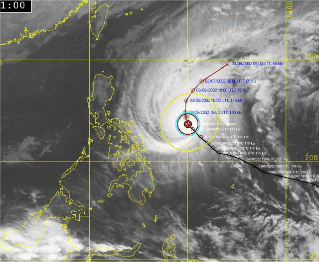
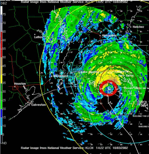
Some examples are shown below..
NOTE: A Pan or Zoom action on these types of maps will result in a standard map (not a satellite or radar image) being drawn at the select pan or zoom level.