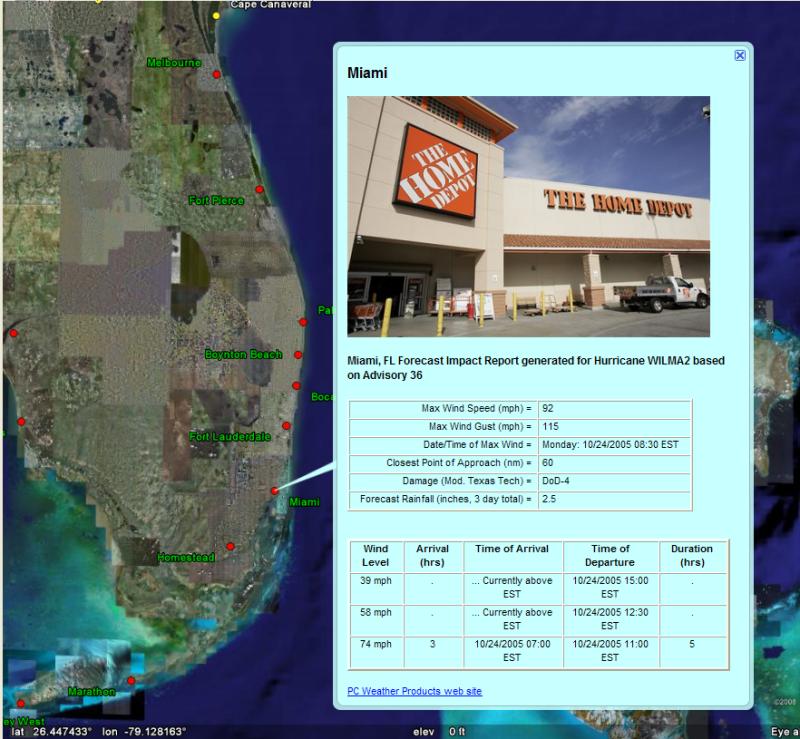
Webcam / Location Images
When exporting the Summary impact report (tab) to Google Earth, you have the ability to view a "live" web cam image of the location being analyzed (if available).
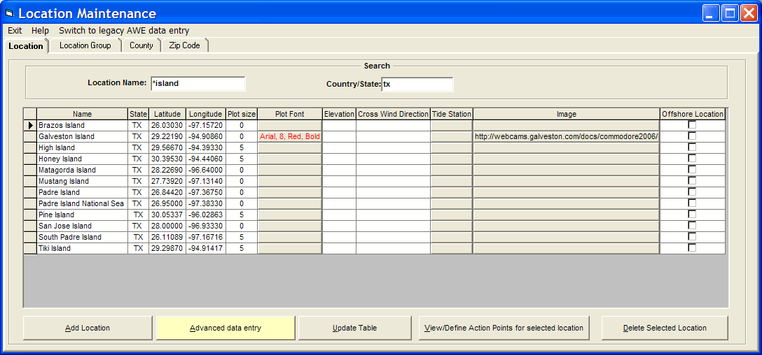
The system is pre-loaded with about 100 web cams links but you can also select custom images (web or local) for specific location in the location database. They just need to be in a graphic format (jpg, bmp, tif, gif). The custom images are defined in the System Setup - Location Maintenance option.
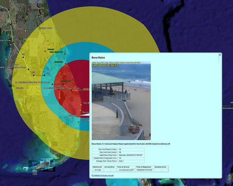
The following Google Earth example shows the beach conditions at Boca Raton along
with the forecast wind impact information for Wilma. (for this example, the image
does not correspond to the same time frame as Wilma).
For some organizations this is a great way to associate forecast wind conditions to a real location. For example a department store could associate static images of each store in the database. When the data is presented on Google Earth, the user can see both the location's forecast impact as well as an image of the site. This capability can be extended to private live web cams. A great example would be a lumber store showing a report for each of their impacted locations with a live image of what is the activity at the current time. A great way to present to management!