Overlay Control Center
Several
modules in the system include the overlay control center… which in short, lets
the user select which GIS type layers are displayed on the “tracking” maps.
The system comes with 35 different type of map layers for the user to choose
from. In addition Hurrtrak
Advanced users have the ability to import their own GIS/Shape files.
The
modules that include this feature include Hurrtrak, Observation display, Model Plot
and Recon Plot.
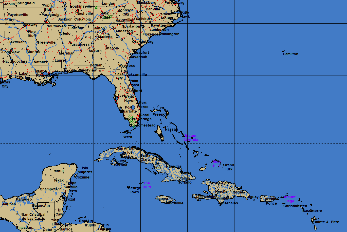
The
image below shows and example of a map with multiple map layers enabled.
In
the Hurrtrak module, you must first select the Map Selection tab in order for this
option to appear in the command bar (first icon on the left).
![]()
In
the other modules, the option is always available on the command bar (2nd
icon on the left).
![]()
When
the Overlay Control Center is selected, the following screen is displayed.
Load
Overlay
– This loads an existing PWC file.
Import GIS File – This option will convert a Shape™ file into PWC format and load it. The user must have some knowledge of the Shape file, particularly its coordinate system, Ellipsoid and UTM zone (if applicable).
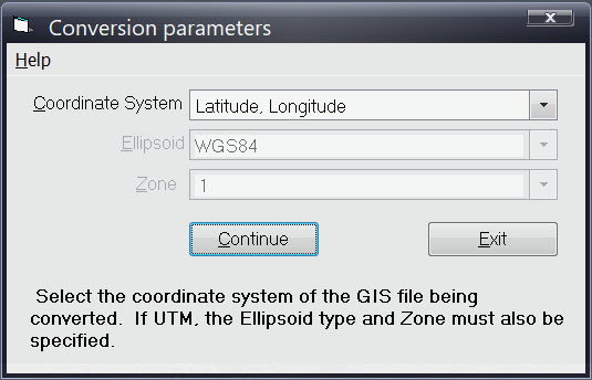
Hide/Show
Overlay
– This option will change the selected layer from being visible to being invisible,
but keeps it loaded at all times.
Remove
Overlay
– This option will remove the overlay.
Autoload
overlay
–
This option will instruct the system to automatically load this layer the next time
HURRTRAK system starts up.
When
you load an overlay it automatically will be loaded the next time.
Move
to Top
–
This option will take the currently selected overlay and make it the top layer.
Overlay
Options
– See more information below.
At
the bottom of the main overlay control screen, there are additional options which
allow the user to control the different types of layer’s font size and appearance.
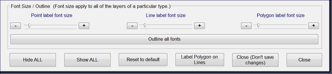
Font
Size Options:
While
different layers can be displayed differently, the font size for one type of layer
is all the same.
i.e.
the font for multiple point layers is the same size.
Label
colors can be assigned by layer.
The
“outline font” option applies to all layer labels and the background outline
is the same as the “land” color.
Hide/Show
ALL:
These
options do exactly what they describe
Reset to Default:
This
option will reset the layers and all attributes to the “as installed” values.
Label
Polygon on Lines:
Sometimes
the display the polygon labels is desired but typically in most cases does not apply
to the types of layers we are displaying.
Close
(Don’t Save changes):
This will close these options and not save any of the change the next time the program
module is opened (i.e. restarting Hurrtrak, etc.)
Close:
This will close and save the changes for the next time the module is opened.