SLOSHView - SLOSH & Inundation Analyzer
SLOSH
In
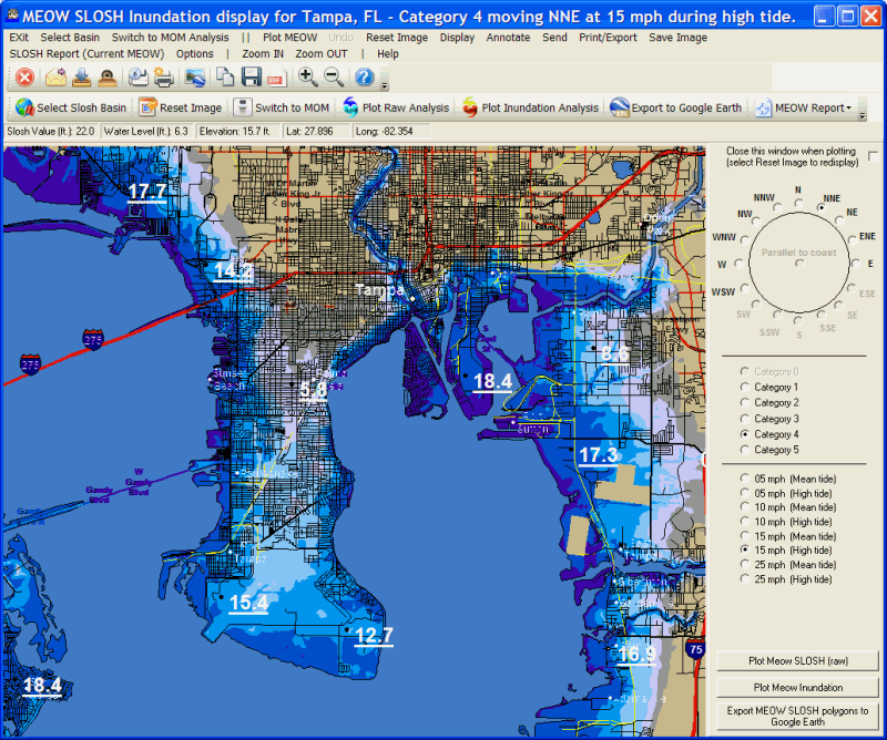
addition to displaying the "raw" SLOSH values, the system will also calculate
and graphically display the inundation analysis... which is the potential water level
above ground as well as generate a SLOSH report indicating potential flood levels
for specific locations. All of this is done on user selectable maps that can
be drawn down to the street level. The mapping database also includes landmarks
such as cities, railroads, airports, pipelines, power lines... and more. For information
on Inundation Analysis see SLOSH
Inundation Analysis.
When
starting the SLOSH
Hurrtrak Advanced users also have the ability to view the SLOSH MEOW data. For the differences between MOM and MEOW see SLOSH Data Summary.
Lets take a look at each SLOSH MODE: