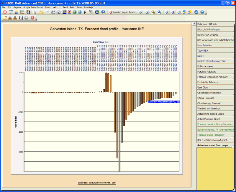
Location/County/Zip Flood Index Profile Tab
Description: This tab graphically display the flood index profile for the analyzed location when performing a location analysis (provided that location has had it's onshore wind flow angle defined). The flood index is not calculated until the location falls within the area of gale force winds. If 1 hour is selected than this represents the flood index for that hour while if 3 hour is selected, then the value represents a 3 hour cumulative total.
Tab Created by: Selecting Graph - Flood Profile from the Location/County/Zip Detail report.
Tab Close Allowed: Yes
Functions Available:
Menu/Toolbar:
Standard System Menu Functions
Send (Email)- Allows the user to send the text, via Email, to another user.
Print Graph - Prints the graph.
Save Image - Saves the image of the graph to a BMP file. The filename is specified by the user.
Toolbars: See Appendix Section for more information.
Tips:
- Pointing and clicking on an observation point will display the date, time and wind data for that point under the graph.
- Flood index calculations are not possible unless the location's flood direction has been identified in system setup - location maintenance.