Wind Pattern
Display
One
of the capabilities of the HURRTRAK system is to display an actual or forecast image
of the estimated winds across a geographic region.
This display is unique because unlike a wind arrow or wind vector display,
this image is a solid pattern that covers every “pixel” location on a map.
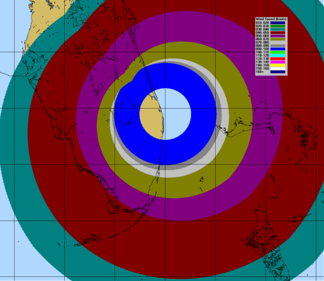
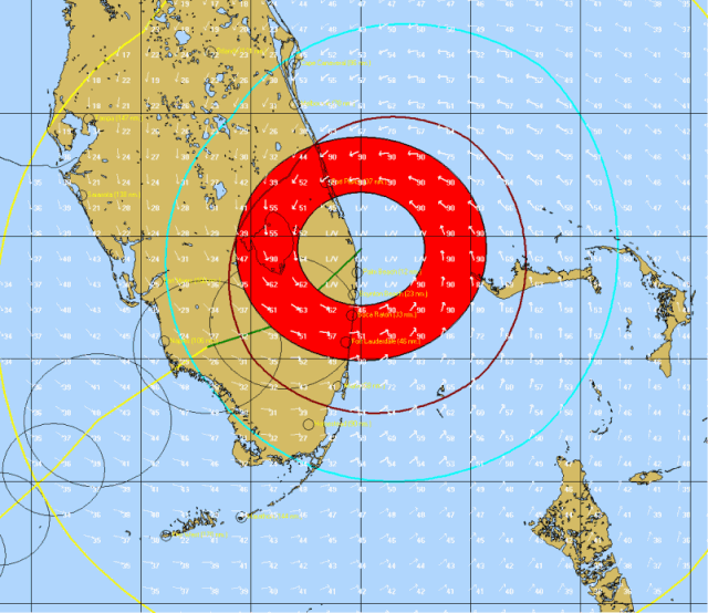
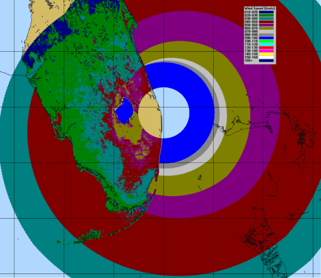
This is best described with the following 2 graphics.
The first one shows wind arrows around a storm.
The 2nd image is the same area described with the “wind pattern”
display.


As
you can see the 2nd image provides much more detail than the first.
This kind of detail, using Advanced Wind Estimation, does come with a cost…
processing time. If not using the pre-processed
RI files, depending on screen size, the rendering of this image may take 20 minutes
or longer. Fortunately, if you download, the
RI files, the rendering time is reduced to less than 1 minute.
You can find our more about the Processed RI files on the topic of Plotting
Options.
The
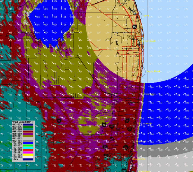
great advantage of the wind pattern display is that “rougher” areas, that
typically reduce sustained winds, are easily depicted.
For example on the image below, you can see the higher winds over and leeside
of Lake Okeechobee with lower winds over the metro areas of Broward, Palm
Beach and Dade counties.

The wind pattern display is available for selection from any tracking chart.
To
view a forecast wind pattern,
the user must first select the PLOT- Forecast Position option from the Map
Select Tab.
Once the forecast
plot is displayed, Display- Wind Pattern can then be selected from the menu.
Wind
Pattern Animation:
- The
user can also select to create an animated wind pattern.
This may take very
long because multiple animation frames are being created.
If
you are going to use this function it is imperative that you download the processed
RI files mentioned on the prior page.
You
can find our more about the Processed RI files on the topic of Plotting
Options.
- After
the wind pattern animation is created, it is not saved unless you select the Save
to Animated GIF option.
It can then be redisplayed
using MS Internet Explorer or some other animated GIF viewer.
One
final note… if AWE is not selected, the resulting Wind Pattern image plots much
faster but does not show the effects of friction on the sustained wind levels.
See image below.
