HURRTRAK Maps / Tracking Charts
The system's mapping capabilities are somewhat varied depending on what type of tracking
map you use.
Fixed Maps - To maintain compatibility with prior versions, fixed maps are available. They are predefined and cover all of the tropical regions.
Pan/Zoom Maps - With Pan and Zoom mapping the user has the ability to zoom in and out, or pan in any direction on ANY tracking map.
Specialty Maps - Radar and satellite tracking chart are special types of fixed tracking charts. The radar and satellite chart (including SST) are obtained via a connection to the Internet. It is important to note that panning or zooming on these types of charts will result in a "standard" tracking map.... not a zoomed in satellite or radar image..
Fixed ("favorite") Maps
How it works...
There are a considerable number of fixed tracking charts that are included with the system. These tracking charts are shown on the "favorite" tracking chart tabs (up to 3 tabs). The user can move from one chart to another by selecting the Next,Prior and Best Map button. Once selected, this map will always be on this tab until changed.
Sizes:
The come in 3 standard sized.. 640x480, 1024 x 768 and 1400x1048. The size map displayed is controlled in General Options.
Custom maps
Five of the fixed maps are actually custom maps. This allows the user to create their own "fixed" map. There are 2 ways to do this.
1. Use the Custom Map Creation Function.
2. From the "Map Select" tab, utilize the "Save as Custom Map" option. This will save the current map view as a custom map.
Misc:
If the user pans or zooms the special topographical fixed map, the re-plotted map will result in a "standard" tracking map, not a zoomed in topographical map.
Pan/Zoom Maps
How it works...
the user has the ability to zoom in and out, or pan in any direction on ANY tracking map. This includes mouse "rubber banding". The system will display the new map area / zoom level and re-plot all of the items originally plotting on the chart. These charts can be zoomed down to street level.
Sizes:
The new map size is dependent on the size of the Hurrtrak "window" as the system will create a map at the largest size possible.
Misc:
- All of the items plotted on the original tracking chart (i.e. forecast track, wind field, locations, etc.) will replot on the new zoomed image. The only exception are any chart notes and legends as they are manually placed by the user.
- The Map Selection Tab is automatically used when the system creates the new map image
- The toolbar has specific icons for assisting the user in the pan and zoom action. The bulls eye icon re-centers the map at the storm location while the arrows will pan the map in the direction indicated.
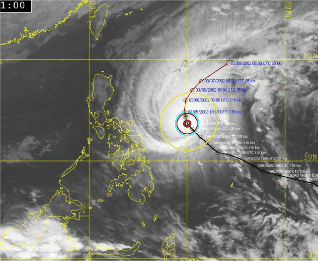
Satellite, SST, and Radar image Maps
How it works...
Hurrtrak Online users are able to plot a storm on certain satellite, Sea surface temperature and Radar images. They can be selected from the "select satellite image" command button or the Satellite image drop down list on any of the "fixed map" tabs. The source for these maps are from 3rd party free Internet web sites.
Sizes:
They come is miscellaneous sizes and can be scrolled if the image is larger than your display area.
Misc:
These images can be quite large (300K) so a fast Internet connection is recommended. An example is shown below. It is important to note that panning or zooming on these types of charts will result in a "standard" tracking map.... not a zoomed in satellite or radar image..